Skip to the content
Wind plays a significant role in shaping weather patterns. Shifts in atmospheric pressure cause air to move, creating different wind speeds and directions. These variations influence everything from temperature changes to storm development.
When a storm begins to form, wind acts as both a driving force and an early indicator of potential severity. Rapid changes in wind speed and direction often signal approaching weather disturbances.
Meteorologists rely on wind speed and direction indicators to analyze these shifts, helping them track developing storms and assess their intensity.
How Wind Speed Instruments Contribute to Storm Predictions
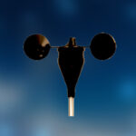
Advanced weather forecasting depends on real-time wind measurements. A wind speed instrument collects data on how fast air moves at different altitudes. Forecasters can predict whether a storm is strengthening or weakening by analyzing this information alongside temperature and pressure readings.
- Tracking Hurricanes – Meteorologists monitor wind patterns to determine if a tropical storm will escalate into a hurricane. Consistent increases in wind speed suggest the storm is gaining strength.
- Identifying Tornado Risks – Sudden wind shifts detected by a wind direction instrument indicate conditions that could lead to tornado formation. This data helps issue warnings before a funnel cloud even touches the ground.
- Predicting Severe Thunderstorms – If wind speeds at higher altitudes are much stronger than those at the surface, a storm may develop strong updrafts, increasing the risk of damaging winds and hail.
Real-World Cases Where Wind Sensors Warned of Disaster
Wind data is valuable in saving lives during severe weather events.
- Hurricane Katrina (2005) – Wind data from aircraft and satellite measurements helped meteorologists predict the hurricane’s strength and path, prompting early evacuations along the Gulf Coast. (Reference)
- Joplin Tornado (2011) – Sudden wind shifts detected by Doppler radar and ground-based wind speed instruments gave meteorologists critical minutes to issue warnings before the devastating EF5 tornado struck. (Reference)
How to Use Wind Speed Data to Stay Safe
Understanding wind patterns can help communities prepare for severe weather. Meteorologists rely on wind direction instruments to provide early warnings, but individuals can also take action based on wind forecasts.
- Monitor Local Weather Reports – Pay attention to changes in wind speeds. Strong gusts ahead of a storm may indicate worsening conditions.
- Take Warnings Seriously – If wind measurements suggest that a storm is intensifying, follow evacuation orders or take shelter immediately.
- Use Personal Weather Sensors—Homeowners and businesses in storm-prone areas can install small-scale personal wind speed instruments to monitor local conditions.
In Conclusion
Wind measurement technology is key in forecasting and disaster preparedness, as extreme weather events always pose severe threats. A wind direction indicator provides valuable insights that help meteorologists and emergency responders anticipate storms before they
strike.
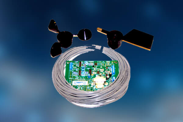
Comptus designs and manufactures environmental monitoring solutions, including wind speed and direction indicators for storm prediction. Weather experts can improve early warning capabilities by integrating wind data into forecasting systems and enhancing public safety.
Discuss with the expert team of Comptus today and know how storm predictions get easier with wind speed indicators.